Glaciation
Updated 14 February 2014
The current landscape of the south Okanagan was largely shaped by repeated glaciations during the Pleistocene Epoch (2.5 mya to 10,000 ya). These repeated glaciations have carved features such as the deep canyons through highly resistant bedrock on Ellis and Penticton Creeks and rounded off the tops of many mountains and hills.
The continental glaciers (as compared to smaller alpine glaciers) were immense. Ice thicknesses of greater than 2000 m were common, and ice covered the tops of all the mountains in the Okanagan region. During the melting at the end of the Fraser Glaciation (~ 15,000 - 12,000 ya) what is now Okanagan Lake was filled with a core of ice, with an ice dam at McIntyre Bluffs. This dam held back meltwaters and filled the valley with a glacial lake, Glacial Lake Penticton. Prior to the breaching of the ice dam at the south end, Glacial Lake Penticton drained to the north into what is now the Shuswap River watershed.
Glacial features in the south Okanagan are of two forms, either erosional or depositional. Erosional features result from the removal of material by ice or melt water flowing over or around a feature. Examples of erosional features are the characteristic shapes of Giant's Head and the Skaha Bluffs. Depositional features are made of material that was left behind following the retreat or melting of glacial ice. Depositional features include the silt cliffs that line valley sides between Summerland and Okanagan Falls and the sand and gravel deposits at Trout Creek and the West Bench.
References
Fulton, RJ. 1969. Glacial lake history, southern Interior Plateau, British Columbia. Geological Survey of Canada, Paper 69-37. Doi:10.4095/106455 http://geoscan.nrcan.gc.ca/starweb/geoscan/servlet.starweb?path=geoscan/fulle.web&search1=R=106455
Nasmith, H. 1962. Late glacial history and surficial deposits of the Okanagan Valley, British Columbia. British Columbia Department of Mines and Petroleum Resources. Bulletin No. 46. http://a100.gov.bc.ca/appsdata/acat/documents/r15765/Glacial_History_Okanagan_1229638479345_3b14c7d11bc41141a63e69fdd84aa684c1f8536fbf3c4a39a4f7248e0349c8fd.pdf
Roed, MA and Fulton, RJ (eds.) 2011. Okanagan Geology South. Okanagan Geology Committee. 238p.
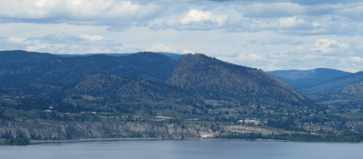
View north from Munson Mtn towards Summerland. Giant's Head shows the distinctive shape of a roche moutonee. Just above the lake, the silt cliffs are visible evidence of glacial lake Penticton. The top of the silt cliffs marks the bottom of the lake, with the water level roughly another 150 m higher. (Photo: T. Redding)
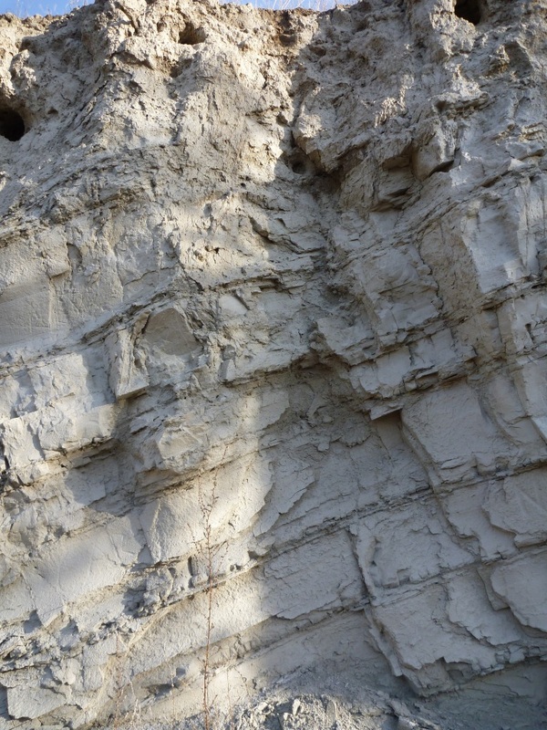
Dipping beds of silt and fine sand along the KVR Trail near Penticton. The thick beds are evidence of high rates of erosion of the recently deglaciated uplands and sedimentation into the lake. (Photo: T. Redding)
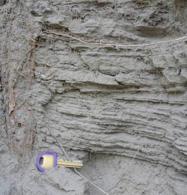
Thin layers of silts and fine sands along Westbench Road. (Photo: T. Redding)
